Green City Studio Publications
Each year, the Master of Landscape Architecture candidates at California State Polytechnic University, Pomona, (Cal Poly Pomona University) partner with communities as part of the Green City Studio – the students’ culminating experience for their degree. Students work with faculty advisors, often in teams, to examine issues and opportunities within the partner communities, and develop strategies to strengthen community resiliency in the face of climate change and other challenges. Projects include illustrative design concepts to illustrate the potential for transformation in southern California communities. The publications on this page are the results of this work. If you would like to learn more about the Master of Landscape Architecture Program, visit the department web site, or contact the faculty of the Green City Studio.

City of Baldwin Park, CA
Destination Baldwin Park: A Community Vision Plan for the City of Baldwin Park, California
Rebecca Cheung, Eugenia Connelly, Hayley Stansell, Tessa Wiley, 2024
Baldwin Park is home to approximately 70,000 residents located on Tongva Land in the eastern portion of Los Angeles County, California, approximately 15 miles east of downtown Los Angeles. The city’s walkable downtown origins, centered on the Pacific Electric (RedCar) Railway, have become embedded in an automobile-centered urban landscape as rail has fallen out of popularity in the last century. Interstates I-10 and I-605 intersect in Baldwin Park’s southwest corner, earning it the title of “Hub of the San Gabriel Valley”. While this may be an economic asset for the city, the dominance of automobile infrastructure presents several challenges common to most Southern California communities. Our vision plan positions Baldwin Park as a memorable destination by highlighting local identity, fostering connectivity, enhancing experiences, and activating new, exciting places. We address community, climate resilience, and sustainability on four functional levels: place, connection, experience, and identity. We create multi-use, neighborhood spaces across the city which are connected via safe, pleasurable pedestrian, bicycle, and public transit networks, elevating the role of each neighborhood in the city as hubs of activity.
City of Huron, CA
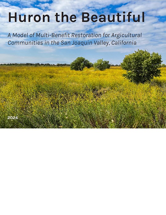
Huron the Beautiful: A Model of Multi-Benefit Restoration for Agricultural Communities in the San Joaquin Valley, California
Connor Rudmann, Antonio Olea, Andy Sett, Francisco Salas-Tamayo, Alfredo Zuniga, 2024
“Huron the Beautiful” is a vision for the future of California’s San Joaquin Valley. As climate change and groundwater depletion threaten the future of industrial agriculture, a new model for sustainable land management and economic opportunity is desperately needed. Forged from a partnership between Cal Poly Pomona’s Department of Landscape Architecture, the City of Huron, the LEAP Institute, and the National Park Service Rivers, Trails & Conservation Assistance, the “Huron the Beautiful” vision plan proposes transforming a 3000-acre federally owned flood detention basin bordering the California Aqueduct into a multi-benefit recreation area that restores native habitat, attracts regional visitors, creates “green jobs,” provides environmental learning opportunities, and empowers local communities through co-management.
City of Maywood, CA
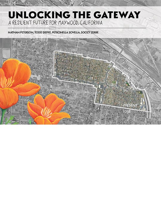
Unlocking the Gateway: A Resilient Future for Maywood, California
Nathan Peterson, Todd Siefke, Petronella Sovella, Soozy Zerbe, 2024
As the impacts of the climate crisis continue to intensify, densely urbanized cities are recognizing their lack of preparedness for future extreme weather events. Many Southern California cities are working to develop Climate Action Plans to create safe and healthy futures for their residents. These plans help identify areas of improvement so that they can achieve their climate goals and adhere to the State of California’s emission reductions requirements. Our study demonstrates the role of Landscape Architects in this process: cultivating creative and tailored solutions for cities as they retrofit to meet future benchmarks. Our vision is for Maywood’s landscape to reflect its residents, prioritizing their needs over industry. Our concept acknowledges the constraints of the city and proposes small, but mighty changes that give the community the tools to be resilient in the face of a changing climate. Our plan includes diverting truck traffic around the heart of the city, a dense ecological buffer for the city edges, converting inner city spaces to reflect the city’s identity, and developing a network of safe transportation and recreation options.
Mono Lake Kootzaduka’a Tribe
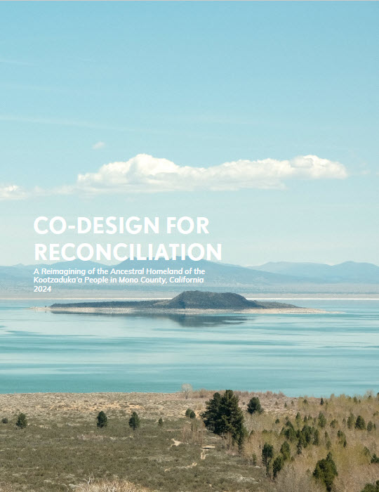
Co-Design for Reconciliation: A Reimagining of the Ancestral Homeland of the Kootzaduka’a People in Mono County, California
Cindy Camberos, Phillip Cooper, Megan Lassen, Julian Ordaz Fernandez, Scott Payne, 2024
The Mono Lake Kootzaduka’a tribe is one of seven traditionally associated tribes of Yosemite National Park, and one of only two who lack federal recognition. As an unrecognized people, the tribe has been denied land ownership, sovereignty, social services, and federal funding. This project originates in that status, and in the tribe’s desire to achieve their goals through alternate means, rather than waiting for federal recognition. The project team worked with the tribe to: (1) co-develop strategies for cultural heritage revitalization and education; (2) help identify opportunities to improve ecological health and resilience to climate change impacts within Kootzagwae; (3) explore potential economic opportunities for the Kootzaduka’a tribe within new projects; and (4), support the tribe’s efforts to become a model for other unrecognized tribes, building capacity through mutually beneficial collaboration with agency partners.
City of Pomona, CA
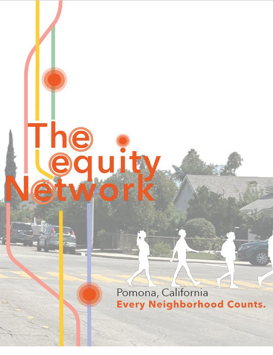
The Equity Network, Pomona California: Every Neighborhood Counts
Chip Erwin, Trinity Gomez, Aliah Mitchell, Abraham Vera, 2024
This project, in partnership with the City of Pomona, California develops an equity-based approach to enhancing green infrastructure, and improving access to amenities for historically underserved neighborhoods. Traditionally, equity has been defined in terms of even distribution of resources, often overlooking historical patterns of unequal treatment. This project focuses on equality of outcomes for each neighborhood to ensure a more inclusive approach. The Equity Network aims to direct resources to areas most in need by establishing vibrant neighborhood centers, enhancing cross-town connections through pedestrian-prioritized infrastructure, and implementing stormwater management solutions. The ultimate goal is to improve the overall quality of life, foster a sense of belonging, develop climate-resilient infrastructure, and enhance pedestrian safety while furnishing the city with access to resources throughout Pomona.
City of Pomona, CA
Fruits of Justice: Sowing Seeds of Resiliency in Pomona, CA
Bess Morin, Sasha Colbert, Maria Vargas, Mel Gross, 2023 (Updated 2024)
California Senate Bill 1000 requires cities to create a plan to combat the unequal distribution of environmental and social outcomes, described as the environmental justice element of a city’s general plan. As part of their effort to comply with this requirement, we were tasked with proposing spatial and policy recommendations for Pomona, a city on the eastern edge of Los Angeles County. In recent years, it has emerged as a warehousing and distribution logistics hub, and the spatial distribution of these uses has contributed to uneven impacts of these developments. Within Pomona, the area we’ve identified as emblematic of these inequities, and chosen to focus on for this proposal, is a mixture of housing, commercial and industrial uses in the eastern portion of the city, referred to in this report as the East Corridors Focus Area.
City of San Bernardino, CA
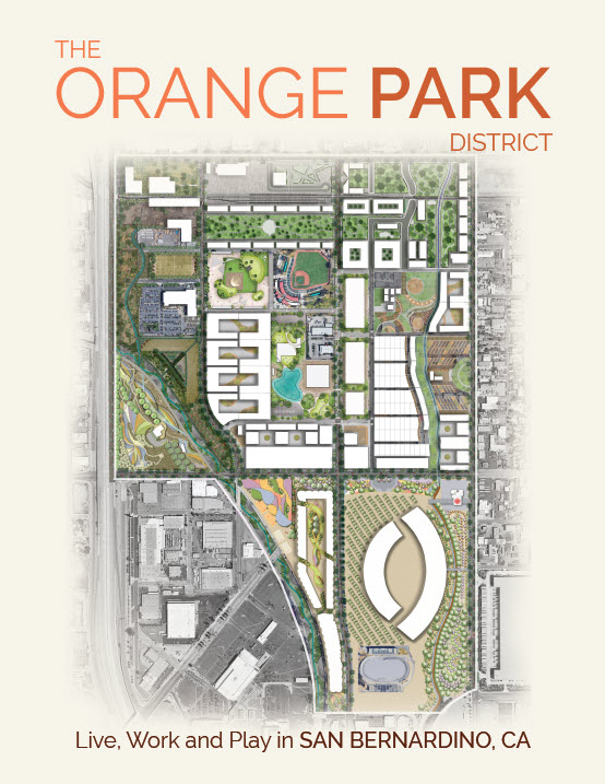
The Orange Park District: Live, Work and Play in San Bernardino, CA
Graham Feltham, Jeanine Sharkey, Karla Valdiviezo, Michael Gallagher, Rania Theodosi, 2023
This report examines the environmental, social, economic, and geological conditions of a 368-acre site south of downtown San Bernardino, California, and proposes the Orange Park District as a full service neighborhood to live, work, shop, and play. The city has proposed the site as a lively entertainment district to attract residents, people who work downtown and in the surrounding area, and visitors from the region who may attend sporting or entertainment events. The concept focuses on restoring the health of the site to create attractive areas where people want to spend time. Design interventions include implementing green streets, revitalizing creeks, building affordable and market rate housing, and ultimately developing a sense of place and everlasting community.
City of San Fernando, CA
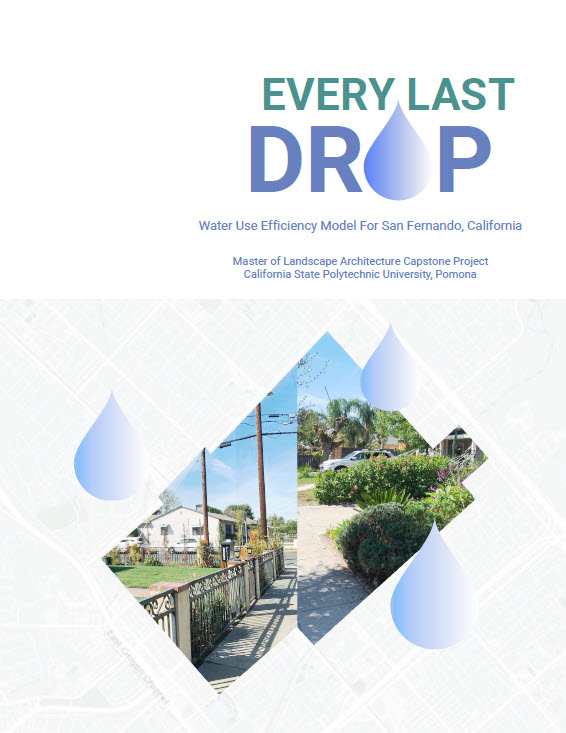
Every Last Drop: Water Use Efficiency Model For San Fernando, California
Sahar Fazelvalipour, Jiyoon Kim, Atticus Lee, Chris Otte, Clarence Vong, 2023
Like many communities in Southern California, the City of San Fernando is challenged with diminishing water resources and increasing state regulation. “Every Last Drop” leads the community toward front yard landscapes that are drought tolerant and are in compliance with California’s statewide Model Water Efficient Landscape Ordinance (MWELO). As students of landscape architecture, our knowledge concerning drought tolerant plants, low impact design, and culturally responsive design can assist the community with the permitting process as it relates to MWELO and move them toward low water use front yard landscapes that retain San Fernando’s unique cultural identity.
City of Bell Gardens, CA
Urban Immunity: Towards a Just COVID-19 Recovery for Bell Gardens, CA
Macy Dreizler, James Kingsbury, Lani Maclean, Ernesto Perez, Glynda Tucker, 2022
In march of 2020, the declaration of a global pandemic ushered in an era of profound uncertainty. Cascading consequences revealed vulnerabilities and inequities that had long been overlooked, as historically disadvantaged communities were devastated. Many residents of Bell Gardens acted as ‘essential’ workers through the pandemic, while bearing the burdens of restricted access to healthcare resources and educational support, and limited access to healthy outdoor environments. Building on research and partnerships initiated by Kounkuey Design Initiative, Urban Immunity examines systemic inequities in place, and the spatial intersections of public health, economic sustainability, education, and community resilience in times of upheaval.
City of Pomona, CA
Enhancement and Resiliency Advocacy Plan for Pomona’s Park System
Carolin Khanlari, Mina Lai, Eduardo Baca, Hector San Martin, 2022
This project aims to advance Pomona’s park system by advocating for a holistic approach that increases park space, enhances park quality and broadens usage while prioritizing the park connectivity systems and the natural park ecosystem. Our approach considers the issues, assets, and opportunities found within Pomona’s transportation, residents, park system, and environmental impact. Together with our partners Clean & Green Pomona and Conexion de Padres, we developed an advocacy plan to help guide the partners’ continued efforts to achieve their vision.
Tataviam Land Conservancy
FACING TATÁVEAVEAT: Planning and Design Strategies with the Tataviam Land Conservancy
Eddie Meyerholz, Hannah Kaiser, Neil A. Heacox, Robert Douglass, 2022
The Fernandeño Tataviam Band of Mission Indians (FTBMI) represents a coalition of lineages that, beginning in 1797, were enslaved at Mission San Fernando from the four socially diverse but politically interconnected regions of Simi, San Fernando, Santa Clarita, and Antelope Valleys in southern California. As part of the centuries-long effort to regain access to its homelands, the FTBMI founded the non-profit Tataviam Land Conservancy (TLC) in 2018 with “the primary goal of conserving lands within the Tribe’s traditional territory for cultural enrichment and educational uses.” This project supports that work of the TLC by proposing a design principles document may guide design in FTBMI territory, and a parcel evaluation model to support TLC decision-making by prioritizing land for acquisition or protection.
Report not currently available for download
City of Covina, CA
Happy Streets Plan: A Destination for Public Health and Shared Prosperity
Philip B. Gann, 2021
The City of Covina, CA in Eastern Los Angeles County. was a citrus-growing community in the early 20th century, and a automobile suburb in the latter part of the 20th century. Its downtown is undergoing regeneration as its economy transitions toward opportunities afforded by convenient transit access to Los Angeles. The Happy Streets Plan addresses concerns around economic and social prosperity, public health, and climate change. The plan focuses on making Covina’s streets and public domain a destination for locals and visitors.
El Sereno, CA
Walking the Same Path: Improving Connectivity, Habitat, and Health for People and Wildlife in El Sereno
Linley Green, 2021
The El Sereno neighborhood in the City of Los Angeles is characterized by stacks of houses on golden hills, and busy roadways connecting residents to freeways and surrounding communities. The steep topography and traffic presents challenges to walkability and bicycle safety, but have also created a relative wealth of open space and habitat opportunity. This plan for El Sereno is centered around enhancing habitat and connectivity for both people and wildlife in order to improve the health of the community and local ecosystem.
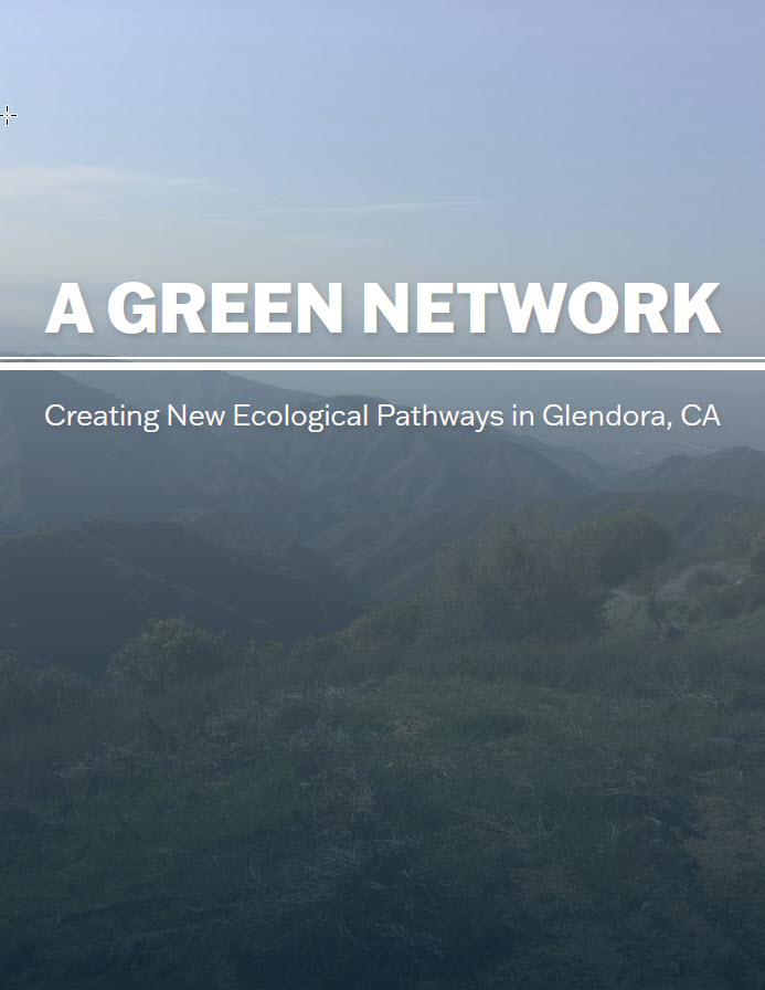
City of Glendora, CA
A Green Network: Creating New Ecological Pathways in Glendora, CA
Sarah Fisher, 2021
The City of Glendora, located in Los Angeles County, California, presents a unique opportunity for connective green infrastructure. It has many valuable ecological resources within the city, such as groves of native coast live oak trees that are vital both for humans and the ecosystem. There is an ongoing effort to bring bike lanes into some of the higher traffic areas by the transportation division of the City. Additionally, a Metro Gold line station is currently being constructed in central Glendora that will bring new alternative transportation opportunities for residents. In response to these issues and opportunities, the project proposes a Greenway along Little Dalton wash to connect the community to vital resources.
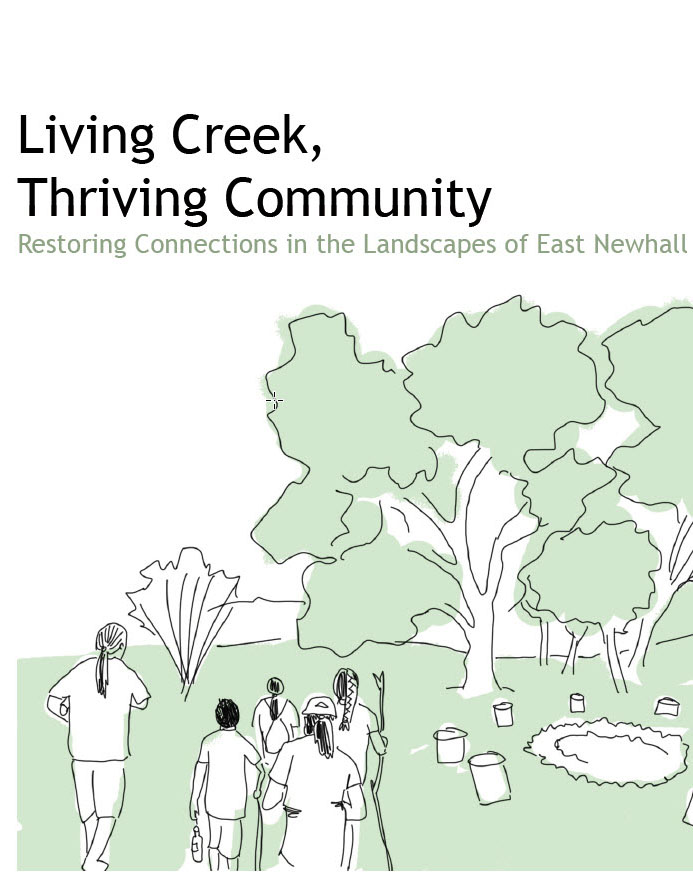
Newhall, CA
Living Creek, Thriving Community: Restoring Connections in the Landscapes of East Newhall
Adrian Tenney, 2021
East Newhall is an historic neighborhood in Santa Clarita, CA, located in Northern Los Angeles County. It features a small, walkable community centered around a transit station, however its residents struggle with economic hardship and limited opportunity, The region is characterized by critical wildlife habitat and native oak woodlands, but is threatened by habitat fragmentation and legacy pollution from mining and other extractive activities. This plan challenges the community to protect their natural ecosystems by expanding protected lands and re-orienting the community away from automobile highways, toward Newhall Creek as a vital connector.
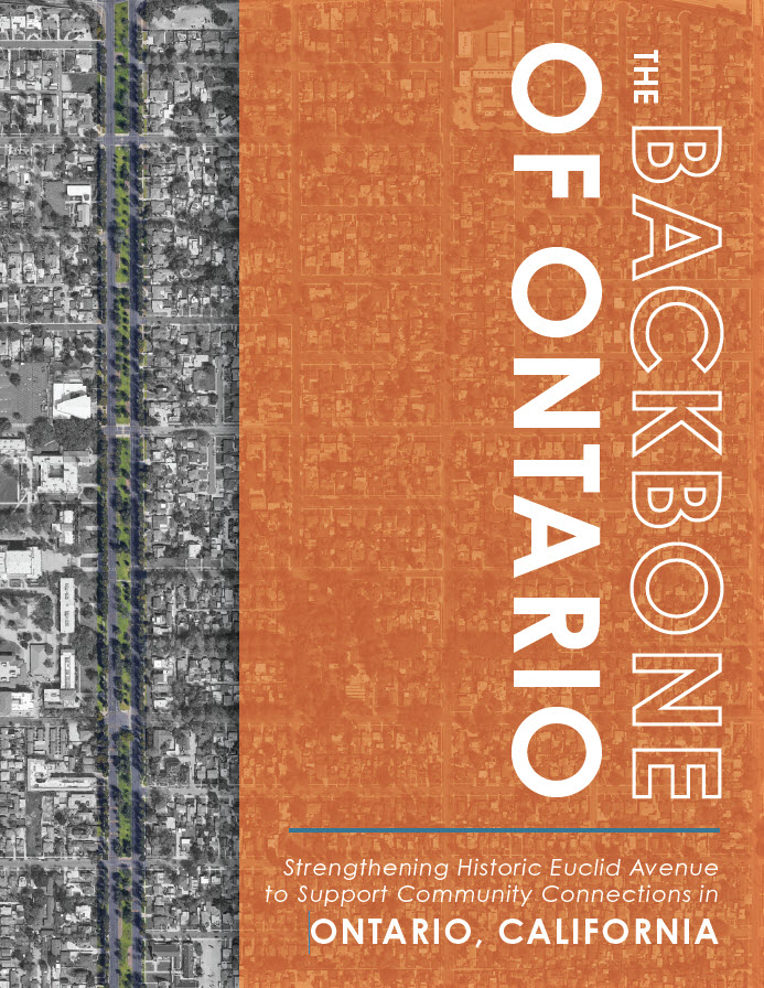
City of Ontario, CA
The Backbone of Ontario: Strengthening Historic Euclid Avenue to Support Community Connections
Michelle Shanahan, 2021
Ontario, CA is located 35 miles East of downtown Los Angeles in San Bernardino County. Euclid Avenue is an historic 6-lane roadway that passes through the heart of the city and features a wide parkway median. While it is valuable open space in a dense urban community with limited parkland, its use is limited by poor pedestrian access and its design. This plan addresses vehicular and pedestrian circulation, stormwater management and historic preservation strategies in an effort to restore the avenue’s role as the backbone of the community.
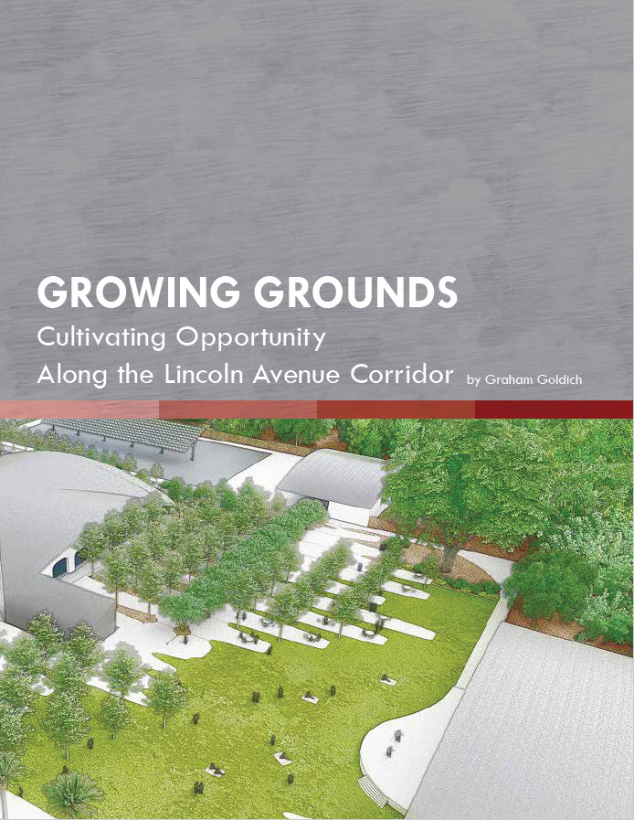
Cities of Pasadena & Altadena, CA
Growing Grounds: Cultivating Opportunity Along the Lincoln Avenue Corridor
Graham Goldich, 2021
Lincoln Avenue is a North/South Road that runs parallel to the Arroyo Seco through parts of Pasadena and Altadena, CA. The corridor features a number of community food assets, including locally-owned restaurants, and grocers, as well as numerous local schools. Located within an historically “redlined” neighborhood, the community has faced economic hardships not experienced by more affluent neighborhoods to the East. This plan cultivates a new food economy for the corridor, focused on accessibility, employment, and culture, which repairs historical injustices of opportunities denied.
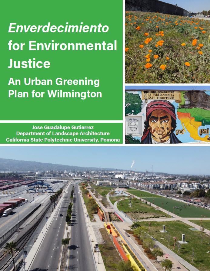
Wilmington, CA
Enverdecimiento for Environmental Justice: An Urban Greening Plan for Wilmington
Jose Guadalupe Gutierrez, 2021
Wilmington is a working-class neighborhood in South Los Angeles, adjacent to the ports. Surrounded by freeways, oil refineries, transportation terminals and other industrial uses, Wilmington residents are subjected to significant pollution exposures. These conditions are compounded by numerous oil wells that dot the landscape. MLA Candidate Jose G. Gutierrez is addressing environmental injustices in Wilmington through strategies for urban greening and reclaiming of polluting sites.
City of Pomona, CA
Gaining Momentum: Moving Towards A Livable, Vibrant, And Resilient Pomona
Sancho Cagulada, Brian Neshek, Morgen Ruby, Laurel Skinner, 2020
A consortium of city departments, institutions and community-based non-profits are pursuing a Transformative Climate Communities Grant for Pomona. The “Pomona ACTS Working Group” has identified a preliminary 5 sq. mile project area and is in the process of developing a grant proposal, which includes downtown, parts of four historic districts, and the future Metro Gold Line station. This project supports the development of the grant proposal, but also expand this work to examine resiliency strategies aimed at strengthening Pomona neighborhoods in the face of climate change.
City of Rancho Cucamonga, CA
Destination Rancho Cucamonga: Leveraging this Community’s Assets Now to Build Resilience for the Future
Raquel Reynolds, Lana Jeries, Christopher Konieczny, Daniel Scheir, Muriel S. F. Replogle, 2020
As the City of Rancho Cucamonga prepared to update their General Plan, several challenges faced the City due to anticipated impacts of climate change. The mitigation of greenhouse gas emissions, the adaptation to anticipated changes, and the strengthening of neighborhoods, are important considerations as they consider the future of their city. These considerations present serious challenges for the city which has grown tremendously around reliance on the automobile and strong history rooted in being a “Route 66” community.
City of Riverside, CA
Neighbor First: Self-Sustaining Communities for a Resilient Riverside
Ava Cheng, Patricia Kaihara, Kay Kite, Lauren McKenna, Brittney Seman, 2020
The City of Riverside is addressing challenges of affordable housing and food security through an ambitious resiliency plan. This includes assessing neighborhoods for the potential integration of housing options, food access, transit connections and other resources essential for daily life. This project supports these City efforts by exploring the nexus between housing and food security, with particular attention paid to the anticipated impacts on climate change.